ROARING FORK BROADCASTING COMPANY

An ongoing trend of more people heading out to play in the backcountry during winters has spurred the Colorado Avalanche Information Center to increase the tools and tactics it uses to try to keep adventurers safe.
Backcountry skiing and snowboarding was already spiking in the 2010s when the pandemic came along and enhanced that trend. The swelling population of the Front Range has meant more people are heading into the hills for snowshoeing, snowmobiling and even car touring — and many of them may not be aware of Colorado’s notorious conditions for avalanches.
CAIC has broadened its approach to sharing information about current conditions. It’s still providing information about specific areas on specific days for the hardcore backcountry adventurer, but it’s also trying to capture the attention of more casual travelers and letting them know that avalanches pose a real threat.
“We’re trying to broaden the number of people that we contact and in some ways are less concerned about what exactly we tell them, as long as they know we’re here,” said Ethan Greene, director of the avalanche center. “They get ‘avalanche’ flashing across their screen so that they know that if they’re headed to go snowshoeing someplace or driving into the mountains or they’re flying into Denver and then moving into the mountains, we want to try to reach those people but really with a very simple message. Whereas somebody that’s living in Carbondale or Telluride or Steamboat, we’re trying to give them a very specific message because they already know that avalanches are important and we’re trying to tell them in more detail what they need to know.
“When you add those together, we’re probably reaching more people,” Greene concluded.
The avalanche center also hired its first public information officer this winter. Kelsy Been of the Roaring Fork Valley was hired to reach more people in more ways about the avalanche conditions and risks.
Numbers on backcountry travel are hard to come by. But sometimes it’s not even people recreating in the backcountry who are affected by avalanches. U.S. 40 over Berthoud Pass closed for three days in mid-January after snow sloughed off steep banks along the roadside and partially buried 10 vehicles. No one was injured but it highlighted how slides have broad potential to cause problems in Colorado.
The Colorado Department of Transportation and the avalanche center teamed Friday to warn travelers heading into the mountains that driving conditions could be tough due to an expected storm. The news release included a heads-up that avalanches are a possibility along some roadways. CAIC issued an avalanche watch on Friday and expects to elevate that to an avalanche warning on Saturday. “Dangerous conditions” are expected throughout the Colorado mountains over the weekend.
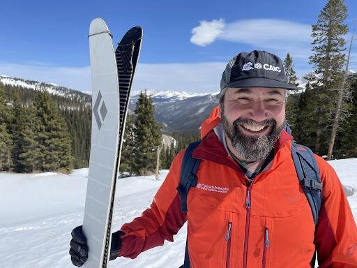
Greene was available to talk about all things avalanche-related with reporters on Thursday. The interviews were arranged by a nonprofit organization called SciLine. It’s a free service for journalists and scientists with a singular mission to enhance the amount and quality of scientific evidence in news stories.
In an interview with the Aspen Daily News via SciLine, Greene explained how Colorado’s avalanche conditions are particularly vexing this winter. Colorado typically experiences dangerous avalanche conditions because snow in the fall sits exposed for so long and develops a weak layer called a basal facet. Once snow starts piling up on that weak layer, slides start occurring. Greene said that pattern is even more enhanced than usual this winter.
“The snow that we had in the fall — October, November, early December — sat around through most of November and December without a lot of insulation,” Greene said. “We really didn’t start building a lot of layers so that snow turned into an exceptionally weak layer. Of course, we see that every year but the magnitude of that weakness — how weak that stuff is — is really quite different this year.”
That’s important for a couple of reasons. First, it’s creating tricky conditions in terrain where veteran adventurers might not be expecting it.
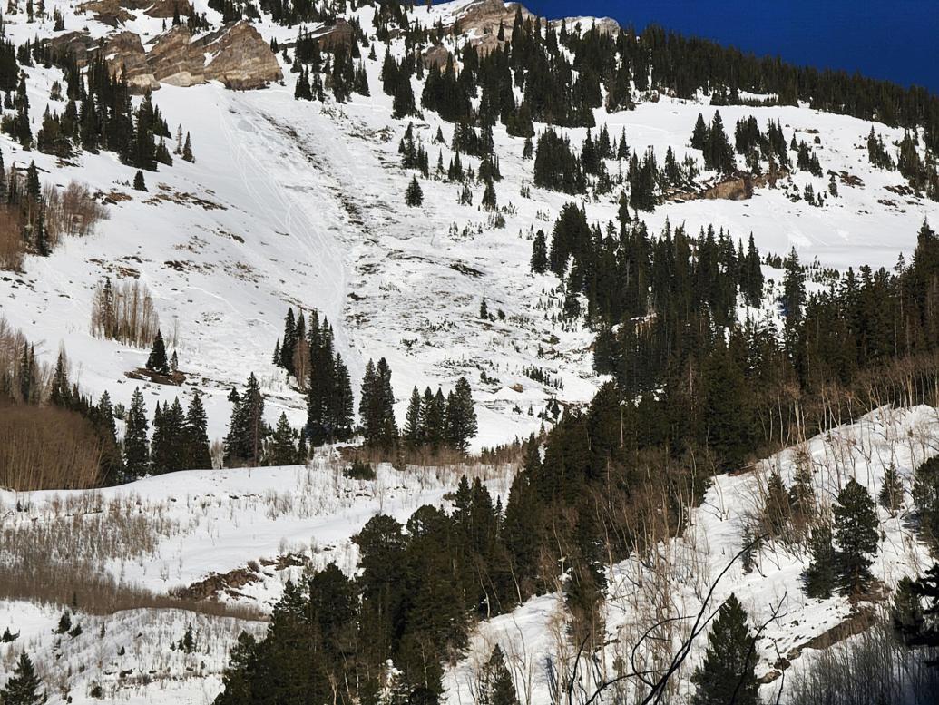
“The more dangerous slopes are near and below treeline and in wind-sheltered areas where the slabs are less dense,” CAIC’s forecast for the Central Mountains, including Aspen and Marble, said on Friday. “In areas with a deeper snowpack, you may trigger a slide if you find a thin spot in the slab.”
In the more detailed section of the forecast, CAIC said the warm daytime temperatures combined with freezing at night have created a crusty surface on southerly facing slopes. Meanwhile, the colder northerly slopes with less sun exposure, a condition known as surface hoar — which shows up as feathery crystals on the snow surface — create their own weak layer.
“The new snow will not likely bond well to either, increasing the avalanche danger,” the forecast said.
The second reason the magnitude of weakness is so important this winter is it sets up the potential for lots of avalanches. That started to become evident with snowfall in December.
“It didn’t take a whole lot when we started loading it up to produce avalanche activity,” Greene said. “In a year where we might start seeing 4-, 6-, 8-, 10-inch events without a whole lot of action, we saw those small accumulation events and we saw fairly significant avalanche activity — fairly wide but not very deep.”
Heavy snowfall from mid-January and into Martin Luther King Jr. Day weekend triggered a “significantly higher” number of avalanches for that period than in a normal year, according to Greene. He said Colorado’s snowpack is now in “two camps.” Where there is a deeper snowpack, the mid-pack layers are the problem. In the shallower snowpack, a slab rests on top of the “really, really weak” layer that can be impacted by people.
“That’s what we’ve seen, especially in the recent weeks — the slabs on top of the weak snow where you can still impact it are now thick enough and big enough to produce pretty good avalanches,” Greene said. “You can still impact those layers and release them.”
The depth of the snowpack is all over the map in the Roaring Fork Basin. The Independence Pass snowpack was only 77% of average Friday morning, according to the automated snow telemetry site east of Aspen. The Fryingpan sites are generally above average, while sites around Marble are below average. Overall, the Roaring Fork River Basin’s snowpack is 96% of average. The differing depths of snowpack create different avalanche conditions.
“If you’re in the Roaring Fork Valley, in Aspen or Carbondale, one day you’re going up Independence Pass or into the Williams Mountains and the next day you’re going to Marble, you may see very, very different conditions,” Greene said. “That’s always the case a little bit but I think the range of conditions that you can see by traveling different directions from a lot of the mountain towns is larger than what we’d see in a normal year.”
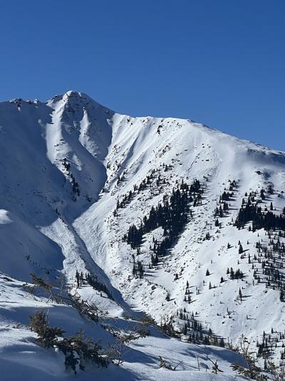
The conditions are setting up to be eerily similar to winter 2018-19. Snowfall was below average for much of that winter until the clouds opened up in March. Sustained heavy snowfall loaded the weak layers until they reached the breaking point. Numerous slides, many at a high magnitude, were triggered. One of the largest recorded in the state occurred in the Five Fingers area, dumping tons of snow and debris into Conundrum Valley, where a home was damaged.
Greene said there are some scenarios where the snowpack stabilizes this winter, but they are unlikely. “We need enough snowfall to build a stronger slab but not too much to produce avalanching,” he said. “Eventually we might get to a better place. The other (scenario) would be to have some huge event that causes most things to run.
“From a safety perspective, the gradual loading is going to make my hair turn gray for a while but would get us to a better place without too many tragic or unusual events,” Greene continued. “From just my personal well-being, a really huge event that caused everything to run, hopefully when everybody is out of harm’s way, would get it over quick, sort of ripping the Band-Aid off so to speak.”
Stay tuned. Mother Nature will play her cards over the next couple of months.